Postdoctor YU Yanyan and Professor GUO Zhengtang develop a new quantitative prehistoric land use model (PLUM) based on semi-quantitative predictive models of archeological sites.
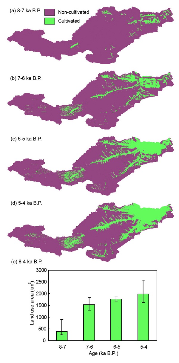
The PLUM is driven by environmental and social parameters of archeological sites, which are objective evidences of prehistoric human activity, and produces realistic patterns of land use. After successful validation of the model with modern observed data, the PLUM was applied to reconstruct land use from 8 to 4 ka B.P. in Yiluo valley, one of the most important agriculture origin centers in northern China. Results reveal that about 2–9% of land area in the valley was used by human activity from 8 to 4 ka B.P., expanding from gentle slopes along the river to hinterlands in middle and lower parts of the valley. The land cover was affected by increasing agricultural land use during the middle Holocene.

Fig. 1. Amount and distribution of land use in Yiluo valley from 8 to 4 ka B.P. (Image by YU)
Yu et al. Reconstructing prehistoric land use change from archeological data: Validation and application of a new model in Yiluo valley, northern China. Agriculture, Ecosystems and Environment, 2012, 156: 99-107 (Download Here)