Professor YANG Xiaoping and his team give results from their studies of dune formation in the Badain Jaran Desert in western China.
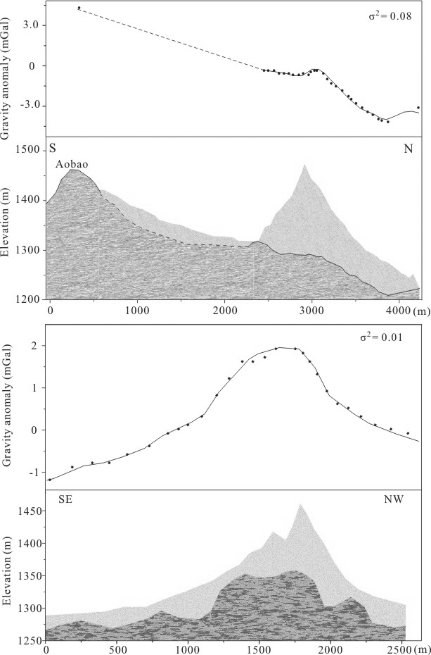
They measure the variability of the dune morphology in this desert on the basis of LANDSAT ETM+ data, and they detect the bedrock landforms beneath the aeolian sands by applying gravity methods. Wind records from stations at the periphery of the desert and SRTM topographical data are examined also to augment the interpretation.
Their studies demonstrate that in addition to average wind parameters, dune height is highly sensitive to local geology, subsurface characteristics, and topography, and interactions between changing climate conditions and aeolian and fluvial processes. These additional factors need to be considered in the interpretation and simulation of dunes on Earth. They anticipate that analysis of anomalous dune heights like those seen in the Badain Jaran may also provide critical information on subsurface characteristics and environmental conditions on Earth and on other planetary bodies.

Fig. 1. Subsurface topography of two locations in the Badain Jaran desert. (Image by YANG)
Yang et al. Formation of the highest sand dunes on Earth. Geomorphology. 2011, 135: 108–116 (Download Here)